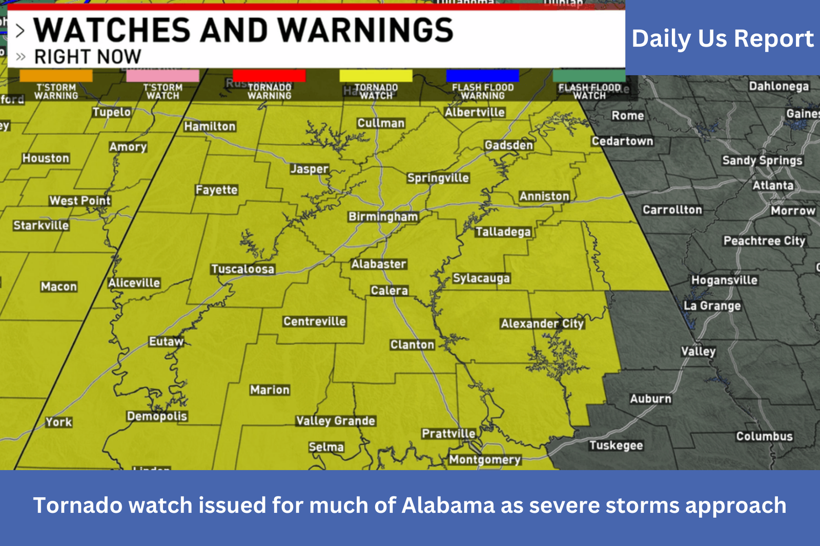

BIRMINGHAM, AL— Much of Alabama, the western Florida Panhandle, southeast Louisiana, central and southern Mississippi, southern middle Tennessee, and coastal waters are under a tornado watch, according to the National Weather Service Storm Prediction Center. The watch is in place from Saturday from 9:10 p.m. until Sunday at 4 a.m. CST.
The chance of a few tornadoes, possibly including a few severe ones, is one of the main concerns. Isolated heavy hail events up to 1.5 inches in diameter are likely, and widespread destructive wind gusts of up to 70 mph are anticipated.
James Spann, chief meteorologist for ABC 33/40, stressed that when the line of storms moves across Alabama, there could be powerful, potentially destructive winds. “With the saturated soil and the potential for damaging winds, you might consider taking action for a severe thunderstorm warning like a tornado warning tonight due to the potential for falling trees,” he stated.
Around 10 p.m., the line of thunderstorms is predicted to sweep into Alabama’s northwest region and swiftly pass through the state during the night. Strong, very destructive straight-line winds and the potential for a few isolated tornadoes, particularly across southwest Alabama, are still the biggest concerns, according to Spann.
“Gradient winds ahead of the line could gust to 30-40 mph in spots; a wind advisory is in effect,” Spann stated. “The line will move quickly, rain amounts should be one inch or less for most places, and major flooding issues are not expected.”