

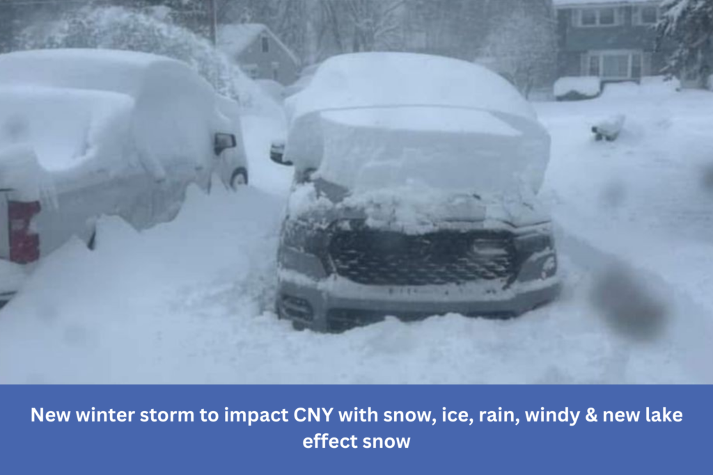
Perhaps you’re wondering why the lake effect snow didn’t turn out as we had predicted.
Snow with a strong lake effect did not travel as far south as we had expected. Lake effect snow bands were able to repeatedly strike the same locations because it stayed primarily north and close to the Route 31 corridor and remained largely quasi-stationary. Because of this, places a few miles south either had very little precipitation or almost no lake effect snow, while parts of Oswego, Oneida, and even the outskirts of extreme northern Onondaga and Madison counties received feet of snow.
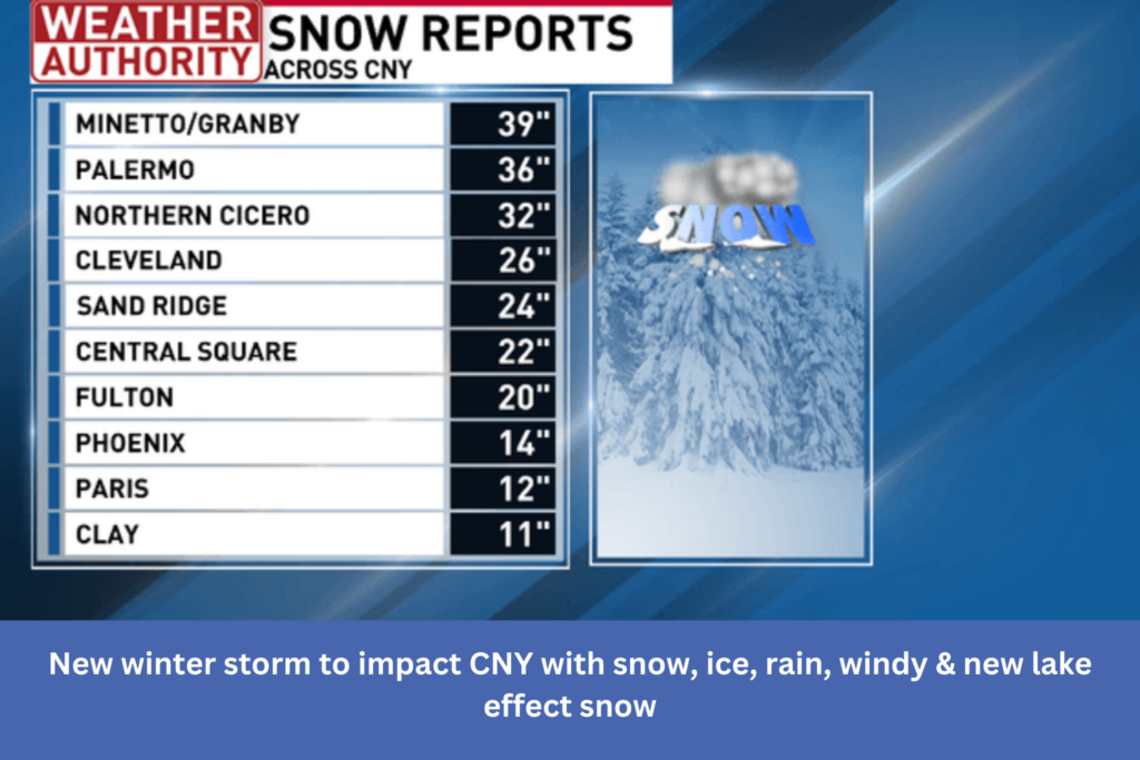
Here is a list of the heaviest lake effect snow:
More active wintry weather is coming after a brief respite for most regions on Friday night into early Saturday morning.
Here are our next weather makers:
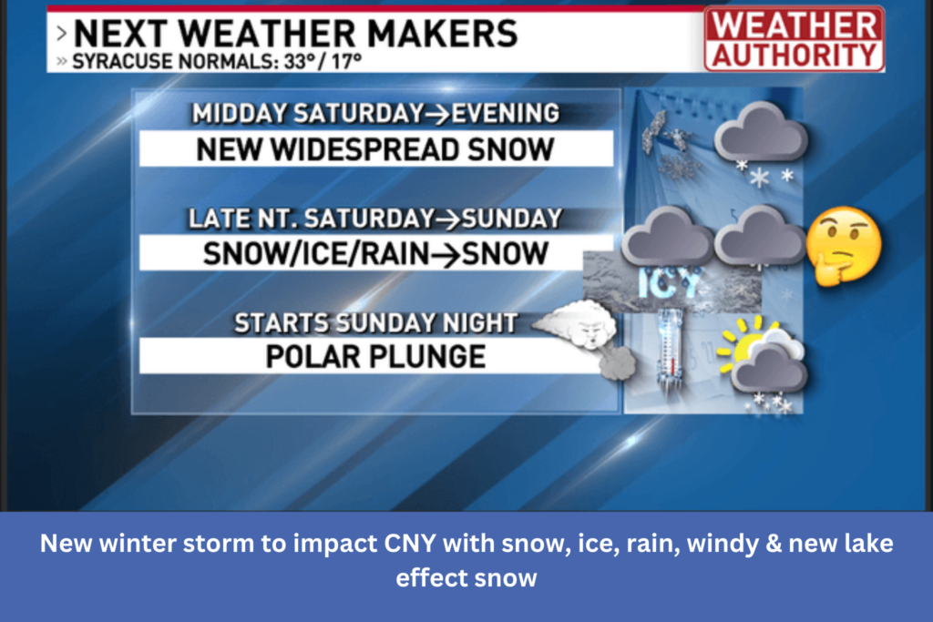
Around noon on Saturday, Syracuse will get widespread light to moderate snowfall (earlier southwest and later northeast). This should allow for snow accumulation until Saturday afternoon in the majority of our area.
The Finger Lakes region and Southern Tier will experience a wintry mix of sleet and/or freezing rain starting Saturday night, followed by the local CNY area and, on Sunday morning, the areas north and east of Onondaga county. On Sunday, the ice will be at its strongest in the vicinity and northeast of Oneida Lake. I’m concerned that there might be more ice and freezing rain in these places. There may be a fair quantity of ice accumulation in the places that get freezing rain or ice the most frequently.
Let’s talk about
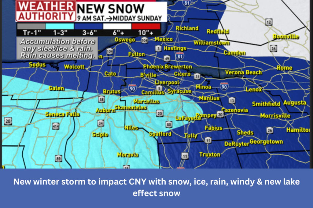
New snow through midday Sunday before changing to a wintry mix/rain for much of Upstate NY:
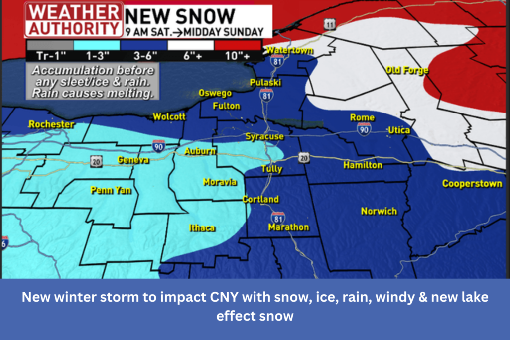
New snow through midday Sunday before changing to a wintry mix/rain for the immediate CNY area:
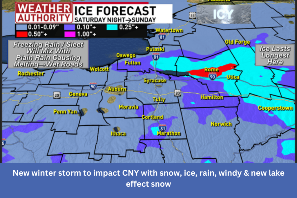
Let’s now see what the area’s ice forecast indicates.
Ice forecast for Saturday night into Sunday for much of Upstate NY before any melting:
Ice forecast for Saturday night into Sunday for the immediate CNY area before any melting:
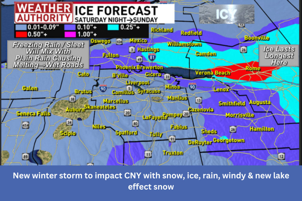
As previously said, there should be less ice in many areas of the Finger Lakes and the adjacent CNY region, and the transition to rain should occur more quickly. Onondaga County’s eastern and northern regions should be noted, particularly those close to Oneida Lake and to its north and east. Recent snowstorm and a strong easterly wind should keep temperatures below 32 degrees for longer. Ice should accumulate more and last longer as a result of this. In addition to making driving considerably more difficult, extremely strong gusts that are expected to emerge on Sunday evening could also result in power disruptions. Wind gusts of 40 to 50 mph should be present in several locations. However, regions east of Lake Ontario and east of Oneida Lake are more likely to experience gusts of 50–60 mph.
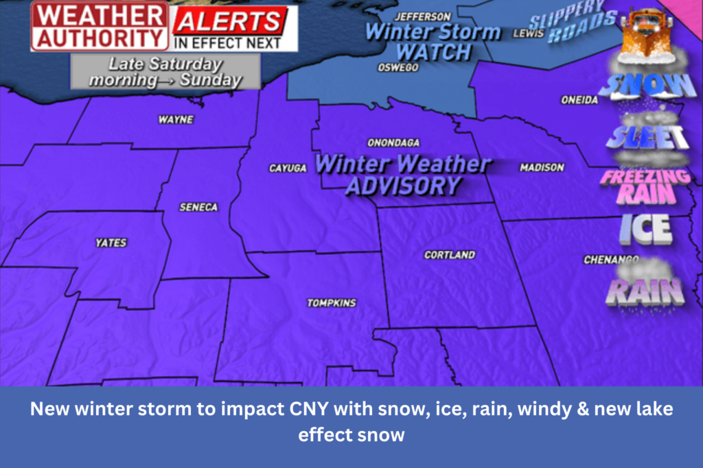
There are weather alerts in effect for this:
Much colder air will return to the entire region on Sunday night due to the high, gusty winds.
Temperatures will quickly drop into the 20s on Sunday night, with snow falling, after hitting the 30s and even 40s in some areas of Central New York. The likelihood of a road flash freeze is increasing. We’ll watch this closely.
New snowfall of at least 2-4″ is expected in many parts of CNY, with areas north of Route 31 potentially receiving up to 8″.
From Monday through Tuesday, there will be more wind and lake effect snowfall. According to preliminary data, there will probably be more substantial snowfall north and close to Route 31, particularly in the areas that were recently affected, possibly along Route 49, and possibly along Route