
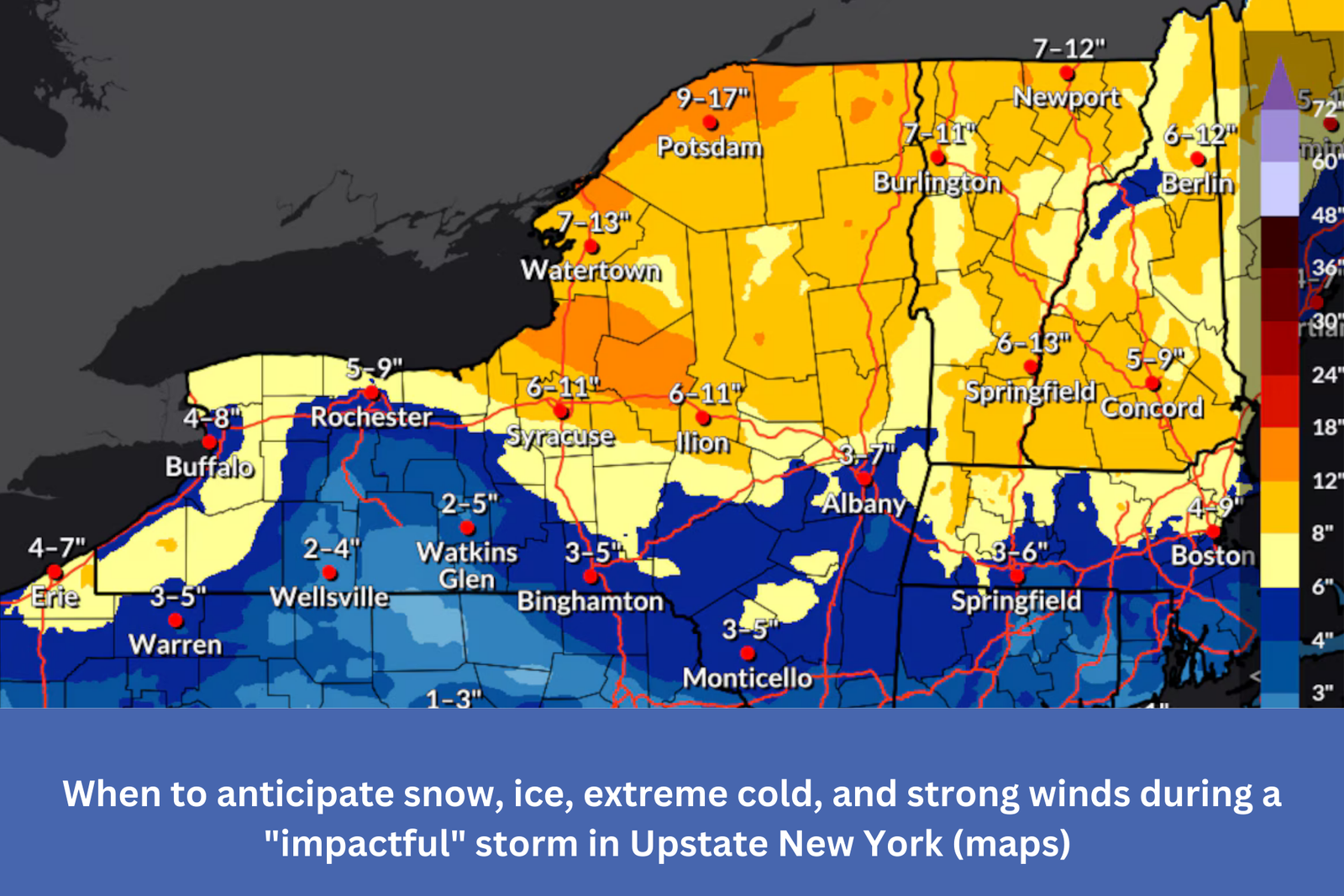
Upstate New York’s predicted snowfall until Monday at 7 p.m. is depicted on this map. The majority of this would occur on Monday throughout the day as a result of the lake effect snow caused by chilly winds.The National Weather Service
Syracuse, New York — This weekend, Upstate New York will be hit by a powerful winter storm that could deliver deadly amounts of snow, freezing rain, and ice through Sunday night.
And that’s only the beginning: the storm’s effects will last throughout the first part of next week, with strong gusts, freezing temperatures, and the possibility of severe lake effect snow through Tuesday. Roads may become dangerous, and ice and winds may result in intermittent power outages.
According to the National Weather Service, “by daybreak Sunday, an impactful storm system will lumber its way from the southern plains to directly over us.”
Numerous weather warnings have been issued by the weather service, such as a high wind watch from the Finger Lakes to the Vermont border and a winter storm warning for the North Country and Adirondacks.
Light to moderate snowfall began this morning throughout Upstate, marking the beginning of the storm’s effects. As the temperature rises tonight, ice and sleet may mix in. On Sunday night, the heavy winds and harsh cold blow in.